Henrikki Tenkanen

Henrikki Tenkanen
Hi, you have landed on the personal website of Henrikki Tenkanen. I am an Assistant Professor of Geoinformation Technology at Aalto University, Finland, where I lead the GIST Lab. I am also an adjunct professor (Title of Docent) at the University of Helsinki (2022) and an Honorary Research Fellow at the Centre for Advanced Spatial Analysis (CASA), University College London (2020).
I am a geographer by training (PhD in Geoinformatics), and my research develops open and reproducible geospatial methods for studying spatial accessibility, human mobility, human-environment interactions and spatial data science. I also build and maintain open-source tools and teaching materials for geospatial analysis in Python.
Latest research
All publications →
Sufficient Mobility and Access Within Limits: Research Agenda for Bringing Together Corridor Frameworks and Transportation Research
Recently developed frameworks that explicitly define boundaries of sustainability, such as "a safe and just space" or "consumption corridors," are key for achieving good lives for all within ecological limits and have been explored in multiple influential studies. However, these "corridor frameworks" have rarely been explicitly applied to mobility and transport, and there is a need for more work in this direction. In this article, we provide an overview of the corridor frameworks and their links to four main strains of mobility and transport literature: sustainable transport, transport poverty, accessibility, and tourism and long-distance travel. The literature traditions have meaningful links to the corridor frameworks, but their approaches to social and ecological justice are largely disparate and disconnected. Existing studies rarely consider explicit ecological ceilings, and when ecological impacts are considered, the focus is usually on efficiency or relative improvements. Transport poverty and accessibility literature provide a meaningful contribution to defining social floors, but they largely neglect ecological ceilings and consumption maxima. Considerations of floors and ceilings are rarely explicit or are based on unquestioned assumptions of necessity and excess. Explicit ecological ceilings and social floors in mobility have been defined at national or global scales, but there is a need for more work on locally-specific thresholds that are distributively and procedurally just. We highlight the need to more comprehensively apply the corridor framework to transportation research and suggest a research agenda with seven main directions.
Heat Stress Prediction in Glasgow: Integration of Historical Data With Machine Learning Models
Urban heat stress is intensifying because of climate change, particularly in densely constructed areas where urban morphology significantly affects thermal conditions. This research examines how vegetation and built form influence heat stress in Glasgow by integrating historical geospatial data, Artificial Neural Network (ANN)-based temperature prediction, and ENVI-met microclimate simulations across multiple greening scenarios applied to vacant and derelict land. ANN notably outperformed Generalized Linear Regression in predicting Land Surface Temperature (LST) and Mean Radiant Temperature (MRT), reflecting the greater sensitivity of MRT to fine-scale radiative and geometric processes. Essential predictors included Normalized Difference Vegetation and Built-up Index, Sky View Factor, and Building Surface Fraction. Scenario-based greening simulations showed that 100% vegetation on vacant lands significantly reduces local thermal conditions, with LST decreasing by 8.7°C and the Universal Thermal Climate Index (UTCI) by 3.3 K. In contrast, full conversion to built-up surfaces increases LST by 1.2°C and raises UTCI by up to 6 K. Despite these pronounced local effects, the net cooling impact at the citywide scale remains limited. Results highlight the necessity of site-specific greening strategies and high-resolution environmental data to enhance predictive precision and support the development of resilient, thermally adaptive urban environments.
GROKE: Vision-Free Navigation Instruction Evaluation via Graph Reasoning on OpenStreetMap
The evaluation of navigation instructions remains a persistent challenge in Vision-and-Language Navigation (VLN) research. Traditional reference-based metrics such as BLEU and ROUGE fail to capture the functional utility of spatial directives, specifically whether an instruction successfully guides a navigator to the intended destination. Although existing VLN agents could serve as evaluators, their reliance on high-fidelity visual simulators introduces licensing constraints and computational costs, and perception errors further confound linguistic quality assessment. This paper introduces GROKE (Graph-based Reasoning over OSM Knowledge for instruction Evaluation), a vision-free training-free hierarchical LLM-based framework for evaluating navigation instructions using OpenStreetMap data. Through systematic ablation studies, we demonstrate that structured JSON and textual formats for spatial information substantially outperform grid-based and visual graph representations. Our hierarchical architecture combines sub-instruction planning with topological graph navigation, reducing navigation error by 68.5% compared to heuristic and sampling baselines on the Map2Seq dataset. The agent's execution success, trajectory fidelity, and decision patterns serve as proxy metrics for functional navigability given OSM-visible landmarks and topology, establishing a scalable and interpretable evaluation paradigm without visual dependencies. Code and data are available at https://anonymous.4open.science/r/groke.
When Proximity Falls Short: Inequalities in Commuting and Accessibility by Public Transport in Santiago, Chile
Traditional measures of urban accessibility often rely on static models or survey data. However, location information from mobile networks enables large-scale, dynamic analyses of how people navigate cities. In this study, we employ eXtended Detail Records (XDRs) from mobile phone activity to analyze commuting patterns and accessibility inequalities in Santiago, Chile. We identify residential and work locations and model commuting routes by public transport and walking using the R5 multimodal routing engine. Spatial patterns are examined using bivariate local indicators of spatial association (LISA) alongside regression techniques to identify distinct commuting behaviors and their alignment with vulnerable population groups. Our results show that while average public transport commuting times do not differ significantly across socioeconomic groups, marked inequalities emerge when accessibility is considered. High-income neighborhoods consistently exhibit high accessibility, whereas low-income areas show substantially lower levels. Importantly, these disparities do not translate into longer commuting times for lower-income groups, indicating a weak relationship between proximity to opportunities and observed travel times. The analysis also reveals significant disparities across sociodemographic groups, particularly in relation to Indigenous populations and gender. The proposed approach is readily scalable and can support evaluations of changes in commuting patterns and the impacts of urban interventions.
The Impact of Land-Use Planning on Lifestyle Carbon Footprints
Research on Consumption-Based Carbon Footprints has recognised that lifestyles change significantly along the urban-rural continuum, with urban typically manifesting as an increase in the footprint of consumption while rural areas have a higher footprint for vehicle usage. However, there is limited research on the extent to which land-use patterns defined by urban plans influence these outcomes. To fill this lack, we controlled for household income and housing type and measured Spearman and Pearson partial correlations between the coverage of different zoning land-use types in the neighbourhoods and the footprints of different subdomains: Goods and services, Leisure travel, Vehicle, and Total footprint. These domains are central to both modern lifestyles and urban planning with related objectives. We found out that high Goods and Services and Leisure travel footprints do align with the urban land-use types, while Vehicle footprints show inverted results. However, the mirrored impact for higher Vehicle and Total footprint is not recognised in exurban areas, while the impact on Goods and services and Leisure travel is inverted. These findings diverge from the common per capita analysis of supply-side emissions used to analyse zoning impacts and call for more detailed research on the net climate impacts of the built environment designated with land-use plans.
Cyclists' route preferences in the electrification era: A case study in Zurich, Switzerland
The electrification of bicycles has introduced new dynamics to cycling, raising questions about how the pedal assistance of electric bikes (e-bikes) influences cyclists' route choice preferences, specifically in various seasons. Understanding these preferences is crucial for developing cycling infrastructure that effectively supports the growing use of e-bikes. This paper develops a route choice framework to examine e-bike users' route preferences and compare them to those of conventional cyclists, using GPS data from the E-Biking in Switzerland (EBIS) project. From the recorded trajectories, 64,340 cycling trips are map-matched by using a trajectory segmentation map-matching algorithm. A data-driven path identification (DDPI) approach is employed to identify the choice set, including only observed routes. A C-Logit (CL) model is then estimated to identify the key determinants of e-bike users' route choices, considering factors such as distance, gradient, age, and seasonal variations. To determine how e-bike users' route preferences differ from those of conventional cyclists, segmented models will first be estimated separately for each bike type, followed by a pooled model. The findings provide a better understanding of how the electrification of bicycles influences cyclists' route choice behaviour, offering policymakers and transport planners valuable insights into the needs of different types of cyclists.
A Methodological Framework for Microscale Mapping of Carbon Emissions from Daily Multimodal Travel: Application to the Helsinki Metropolitan Area
Urban transportation is a key challenge for achieving climate neutrality. However, effective intervention is hindered by a lack of granular data to identify spatially heterogeneous emission hotspots, as scalable approaches for jointly estimating private car and public transport (PT) emissions at high resolution remain scarce. This study introduces a hybrid bottom-up framework to address this issue. By integrating mobile phone-based travel demand data, unified multimodal routing and Life Cycle Assessment (LCA) emission factors, daily travel related CO2 emissions is mapped at high spatial resolution in the Helsinki Metropolitan Area. The results reveal pronounced spatial disparities: while the inner-city core exhibits high emission intensity across all modes, car emissions in the suburban periphery are found to exceed public transport emissions by over 50 times. Inspecting the emission patterns against underlying urban structures, the key findings show that high-emission clusters align with areas of high income and low job density, with the highest total emissions occurring in a suburban zone 10-20 km from the Helsinki city centre. The emission estimates were validated against municipal inventories, showing an overall agreement with the annual totals. The presented approach offers a diagnostic tool that can be beneficial for transport planning and policy to target decarbonization interventions and efforts to areas where they have the most impact.
Making waves: A conceptual framework exploring how large language model-based multi-agent systems could reshape water engineering
Large Language Model-based Multi-Agents (LLM-MAs) are emerging systems that manage complex tasks with specialized and coordinated agents. In this paper, we present new perspectives on the integration of LLM-MA systems into enhancing water engineering practices. Water engineering typically involves data integration, analysis, modeling, decision-making, and cross-disciplinary collaboration, which often present significant difficulties. To address these domain-specific complexities, we explore how LLM-MA systems can support advanced operations in water engineering and facilitate them. By pointing out the linguistic capabilities of LLMs and the modular, scalable, and collaborative architecture of LLM-MA systems, we investigate the role of intelligent agents in enabling timely, adaptive, and traceable solutions. Various practical applications were identified, e.g., LLM-MA for pressure drop detection in water distribution networks, flood management, or in their role as potential negotiating agents to find a balanced solution considering differing goals. Our investigation highlights both the capabilities and limitations of LLM-MAs in water engineering and proposes practical recommendations for their effective implementation within the field. This study seeks to develop a foundational framework for understanding how LLM-MAs can shape the future of water engineering processes.
Global gridded population datasets systematically underrepresent rural population
Numerous initiatives towards sustainable development rely on global gridded population data. Such data have been calibrated primarily for urban environments, but their accuracy in the rural domain remains largely unexplored. This study systematically validates global gridded population datasets in rural areas, based on reported human resettlement from 307 large dam construction projects in 35 countries. We find large discrepancies between the examined datasets, and, without exception, significant negative biases of -53%, -65%, -67%, -68%, and -84% for WorldPop, GWP, GRUMP, LandScan, and GHS-POP, respectively. This implies that rural population is, even in the most accurate dataset, underestimated by half compared to reported figures. To ensure equitable access to services and resources for rural communities, past and future applications of the datasets must undergo a critical discussion in light of the identified biases. Improvements in the datasets' accuracies in rural areas can be attained through strengthened population censuses, alternative population counts, and a more balanced calibration of population models.
Stronger together: integrating geospatial data to understand human outdoor recreation
Outdoor recreation is an increasingly important activity worldwide. To support outdoor recreational opportunities, it is essential to understand when and where people recreate, what they do when recreating, who are using the outdoor spaces for recreation, and why. Human outdoor recreation behavior has been increasingly studied with a variety of novel geospatial data sources that have become available in the past few decades. Multiple studies have applied user-generated geospatial data from social media, mobile network operators, GNSS/GPS tracking, or participatory mapping to understand outdoor recreation. Yet, the extent of the use of these data sources remains unclear. In this scoping review, we characterize the quantity and quality of the literature using geospatial data sources and further outline what types of information have been drawn from these data sources. Our review shows that the analyzed geospatial data sources vary considerably in terms of the depth of relevant information that can be extracted from them. Future research and management interested in human outdoor recreation should apply a combination of geospatial data sources, mixing especially active and passive sensing approaches to unlock their information and knowledge potential.
Spatial accessibility and transport inequity in Finland: Open source models and perspectives from planning practice
During the last two decades, accessibility has begun to take a more central role in transport planning and decision making, as its importance has been recognized in many different policy agendas. Although environmental and social sustainability are central in contemporary public policy, the social exclusion effects related to access of opportunities are rarely measured at the national level. In this study, we analyze spatial accessibility to various opportunities in Finland at 1 km resolution and assess accessibility inequalities using the Palma ratio. Furthermore, we test how a web-based tool can be used in stakeholder communication and investigate the usefulness of the accessibility indicators and the tool for planning practice based on focus group discussions with Finnish transport planners. Our results show significant variation in the levels of access to different opportunities across Finnish municipalities. The Palma ratios reveal that the largest disparities are typically located in municipalities surrounding large city regions, where wealthier residents tend to have better access to opportunities compared to low-income populations. Finally, the insights from Finnish planning practitioners reveal that communicating national-level accessibility information via an online tool has high communicative and learning value for various planning and policy processes.
Making Cultural Ecosystem Services Truly Cultural: Mapping Outdoor Experiences in Ukraine with Telegram
Mapping and assessing cultural ecosystem services (CES) poses a great challenge of quantifying intangible benefits and values. This challenge becomes even more pronounced in context of war. This work-in-progress study introduces a novel, spatially explicit methodology that utilises the Telegram messenger, widely used in Ukraine, to democratise participatory mapping. Our approach aims to explore how Ukrainians value their time spent outdoors and how these perceptions have changed since the full-time Russian invasion. By framing CES as a cultural experience without rigid categorisation, this study uses a location-based service to capture the diversity of outdoor experiences.
Threats related to open geospatial data in the uncertain geopolitical environment
During the last few decades, there has been increasing interest in open data, especially with regards to the public sector. Open data promotes transparency in the society, and the availability of data creates significant additional value. There are also potential threats associated with open data. After the Russian invasion of Ukraine, threats to society and national security related to open data have been given a lot more attention than before. Here, we conducted group interviews with a number of security experts in Finland to investigate potential threats related to open data and society. Based on the interviews, we created a number of threat scenarios that were further refined and discussed with experts. We recognized a large number of different potential malicious actors, ranging from hostile nations to individual criminals. The threats these actors might cause are varied, and for many, the best ways to mitigate the threat are not, in fact, related to open data themselves. In addition, changes to open datasets can have significant side effects that also need to be taken into account when considering how to manage the potential threats. Our study concludes that decisions to open new datasets, or to modify already existing ones, need to be made with care, and threat and risk assessment must always be weighted against benefits of publishing the data, as well as drawbacks of leaving the data unpublished.
Compact city and urban planning: Correlation between density and local amenities
Many scholars and planners emphasise the role of compact cities in sustainable urban development. Compact urban form is seen as a way to encourage people, for example, to drive less and walk more, which reduces transport-related GHG emissions. This argument, however, is strongly dependent on local amenity development that can support such local living. In plan-making, a common practice is to try to ensure the realisation of services with a high Gross Floor Area (GFA) residential infill development to raise the local population density. In this paper we are seeking quantitative insight on the resolution under which urban density, as measured by GFA volume, correlates with the growth of urban amenities and liveability. Specifically, we are seeking the direction in which correlation changes when moving from a larger geographical scale (low resolution) towards a smaller scale (high resolution) of walkable reach. Our study shows a clear correlation between urban amenities and planned GFA at low-resolution scales, but that correlation decreases at higher-resolution scales (walkable neighbourhood level), indicating that urban amenities tend to cluster in different locations than density is planned. Based on these findings, we argue that, if the aim of urban planning is to foster the growth of local amenities, it should shift its focus towards larger patterns of urban development rather than emphasising GFA in detailed plan-making.
A data-driven approach for estimating travel-related carbon emissions with high spatial and temporal granularity
The transport sector is the second-largest contributor to greenhouse gas emissions in the EU, with a high reliance on fossil fuels and increasing demand for transportation. In Finland, cars are the most common means of travel, accounting for 60% of overall domestic travel. Considering that a significant portion of the work-related trips in Finland (70%) are done by car, there exists great potential to reduce travel-related emissions by substituting short-distance work trips with active transport. Typically, the potential for reducing travel related carbon emissions are studied using travel surveys or other national level statistics. However, there is little geographical evidence regarding the extent of carbon reduction potential achieved through the shift to active transportation, i.e. where the carbon-reduction potential is highest? This study aims to develop a data-driven method to assess the potential reduction of carbon emissions from commuters switching from car to more sustainable travel modes. As a case study, we investigate the carbon reduction potential in Otaniemi, Espoo (Finland) which is a major commuting hub with large business corporations and research institutes. More specifically, we analyze and simulate the influence of replacing short car-based commuting trips with trips done by electric bikes. Furthermore, we investigate the change in commute-related emissions to Otaniemi before and after the pandemic. Our results show that there were major changes in the work-related travel demand that significantly reduced the carbon footprint from commuting. In addition, our simulation shows that there exists significant potential to reduce travel-related emissions if short car trips (less than 5 km distance) would be done by e-bikes instead of cars. Our approach shows great potential for providing crucial place-based information for employers and policymakers to promote sustainable mobility cultures and effectively target climate mitigation policies.
Measuring just accessibility within planetary boundaries
Our societies struggle to provide a good life for all without overconsuming environmental resources. Consequently, scholarly search for approaches to meet environmental and social goals of sustainability have become popular. In transport research, accessibility is a key tool to characterise linkages between people, transport, and land use. In the current paper, we propose a conceptual framework for measuring just accessibility within planetary boundaries. We reviewed transport studies and discovered a substantial literature body on accessibility and social disadvantage, much vaster compared to the literature around environmental and ecological impacts of accessibility. We also show a gap in approaches that have integrated these two perspectives. Building on the review, we suggest a conceptual framework for incorporating environmental and social sustainability goals in accessibility research. We conclude the paper by pointing to key challenges and research avenues related to the framework, including (i) dealing with uncertainty and complexity in socio-ecological thresholds, (ii) integrating environmental limits into the conceptualisations of transport equity, (iii) measuring accessibility through other costs than travel time, and (iv) integrating both quantitative and qualitative data.
Active projects
All projects →
Geo-R2LLM
2025-2028Building geographic large language models enhanced through retrieval and reasoning over multimodal knowledge for context-aware navigation in complex urban environments.

Hands-on GeoAI
2025-2026Joint Aalto-TU Graz online course introducing machine learning, deep learning, foundation models, and AI ethics applied to spatial data.

Geoportti RI
2025-2029Shared digital research infrastructure giving Finnish scientists centralised access to geospatial data and HPC/cloud geocomputing resources.
MAPICO
2023-2027Quantifying daily-commute carbon emissions in urban areas at high spatial resolution using big data and probabilistic approaches across Nordic cities.
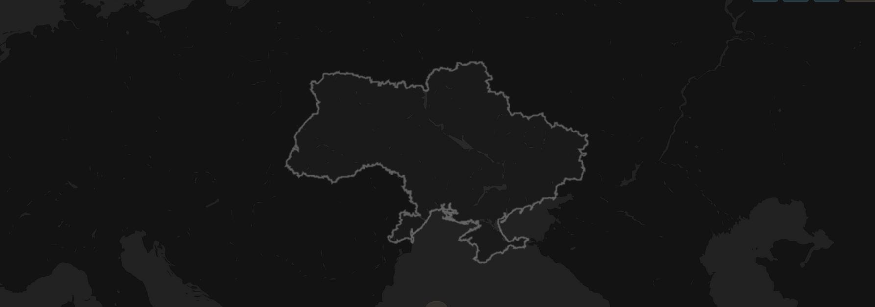
UKRAINABILITY
2024-2027Tracking how Russia's invasion has reshaped people-nature relationships and landscape sustainability in Ukraine, combining social media analytics, remote sensing, and a Telegram bot for citizen observations.